Saudi Arabia · Riyadh · Jeddah · Eastern Province · NEOMProject enquiries · Secure request form
Case study · Riyadh

Takamil Tower Concrete Scanning & Coring Clearance

Targeted concrete scanning at Takamil Tower in Riyadh to locate reinforcement and embedded features before coring, helping the construction team choose safer drilling positions.

LocationRiyadh
ServiceConcrete Scanning
ScopeTargeted structural zones
Depth / targetElement-dependent
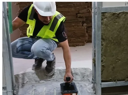
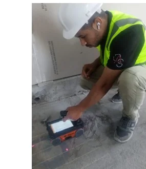
Representative archived survey method image; not necessarily captured at this project
Representative method image from the field archive; not a confirmed image from this project.
Project context

Why this investigation mattered

Coring through an unknown slab or wall can damage reinforcement, conduits or other embedded systems. The challenge is not only to “see rebar,” but to give the drilling team a practical clearance decision at the exact locations where work is planned.

Structural elements can contain multiple reinforcement layers, varying cover, congested zones and interfaces that produce complex radar responses. Interpretation therefore needs to be tied to the actual coring location and to the limitations of scanning from the accessible face.

Investigation strategy

High-resolution concrete scanning was focused on the proposed coring zones. Survey lines were arranged to recognize repetitive reinforcement patterns and distinguish them from less regular embedded features.

The field output prioritized practical marking and clearance information. Where the scan could not confidently rule out an embedded target, the location was treated conservatively instead of being declared safe by assumption.
Field-to-report workflow

How the project information was developed

The workflow is documented so the case study provides engineering context—not just a marketing summary.

  1. 01
    Confirm proposed coring points and accessible scan surfaces.
  2. 02
    Scan in orthogonal directions where practical to establish reinforcement patterns.
  3. 03
    Interpret rebar spacing, cover trends and non-repetitive embedded responses.
  4. 04
    Mark relevant findings / exclusion zones for the site team.
  5. 05
    Document limitations caused by access, element thickness or congested reinforcement.

Interpretation and engineering use

The scan gave the coring team a better basis for selecting drilling locations, reducing the chance of cutting reinforcement or striking hidden services and helping avoid unnecessary structural repair or programme disruption.

Quality control

  • Where practical, scan directions were arranged to reduce orientation bias.
  • Repetitive reinforcement patterns distinguished from isolated embedded anomalies.
  • No “clear” location should be issued where the accessible scan face cannot support that conclusion.
  • Field markings and reporting linked to the actual proposed work zone.

Project deliverables

  • On-site interpretation / marking for targeted zones.
  • Reinforcement and embedded-feature information.
  • Coring clearance guidance subject to stated limitations.
  • Technical notes or reporting as required by the project.

Technical limitations

Concrete GPR results depend on accessible scan surface, reinforcement density, element thickness, moisture and target orientation. Scanning one face cannot always characterize every embedded feature through the full structural element.

Project FAQ

Questions this case study answers

What was the purpose of the Takamil Tower scan?

To support safe coring by locating reinforcement and embedded hazards in targeted structural zones.

Does concrete scanning guarantee a completely clear core path?

No. Results depend on access, element geometry and signal conditions; uncertain zones should be treated conservatively.

Is the scan destructive?

No. GPR concrete scanning is a non-destructive investigation method.

Plan before you excavate

Need subsurface information for a project?

Send the site location, survey area or route length, target depth and available drawings through the project request form.